News
Garmin adds 1.3 million mapping updates with latest release
Delivering more than 1.3 million updates to coastal charts and inland maps around the world, Garmin’s new g3 v2022.5 cartography provides boaters, anglers and sailors alike with a host of new content to improve their time on the water. From hunting down fish-holding structures to exploring new waters, updated marine charts offer essential tools needed for better situational awareness and easier decision-making during navigation.
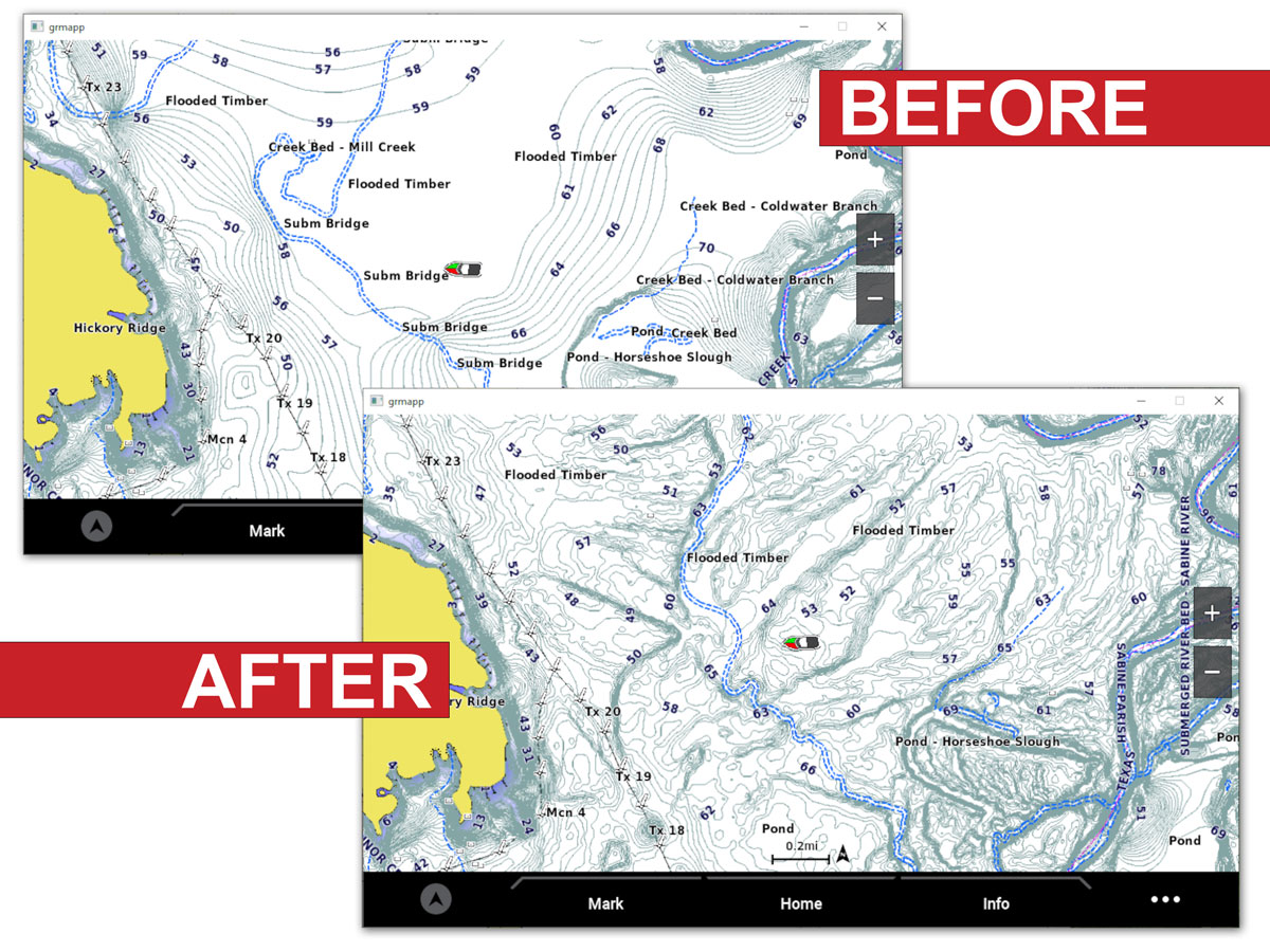
In addition to coverage for over 42,000 lakes Garmin g3 v2022.5 adds updated global chart content, updated NOAA raster charts, new and updated survey lakes, new sonar imagery lakes and more for BlueChart g3 and BlueChart g3 Vision coastal chart users, as well as LakeVü g3 and LakeVü g3 Ultra inland map users.
Inlcuded in the update:
- Global chart content
- Updated NOAA raster charts
- New and updated survey lakes
- New sonar imagery lakes and more
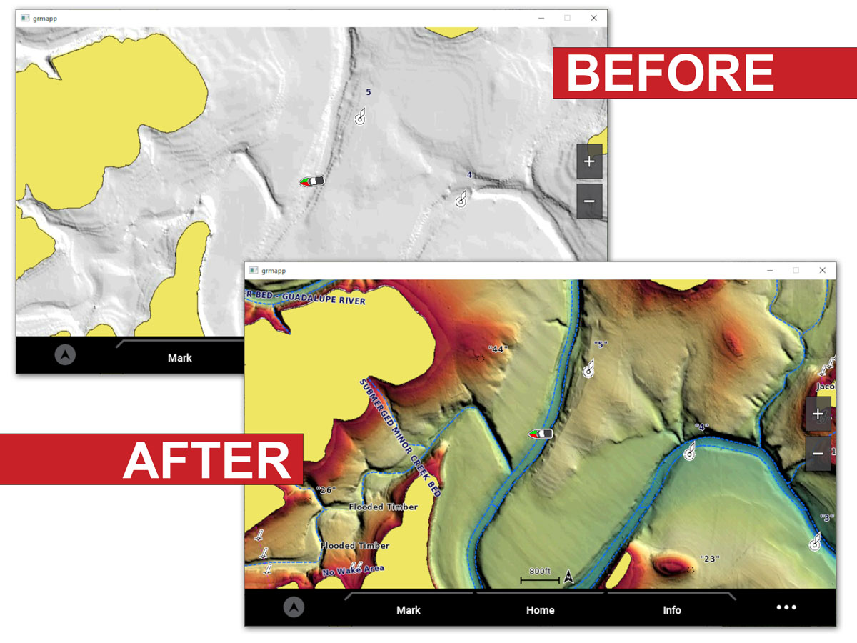
- High resolution relief shading
High-resolution relief shading - a preloaded feature in the U.S. for BlueChart® g3 Vision and LakeVü™ g3 Ultra - uses a blend of color and shadow to create an easy-to-interpret, multidimensional view of the terrain below the waterline. This means you can more intuitively track down fish-holding structure, artificial reefs or unique diving locations.
New U.S. survey lakes with high-resolution relief shading:
- Sardis Lake (OK)
- Lake Buchanan (TX)
- Canyon Lake (TX)
- Lake Granbury (TX)
- Stillhouse Hollow Reservoir (TX)
- Lake Waco (TX)
Possum Kingdom Lake (TX) and Toledo Bend Reservoir (TX) also feature detailed improvements to existing high-resolution relief shading coverage.
Comments
Be the first to comment on this article!